When a Game Map Becomes Drone Training Data: The Human Consent Question Behind AI Navigation
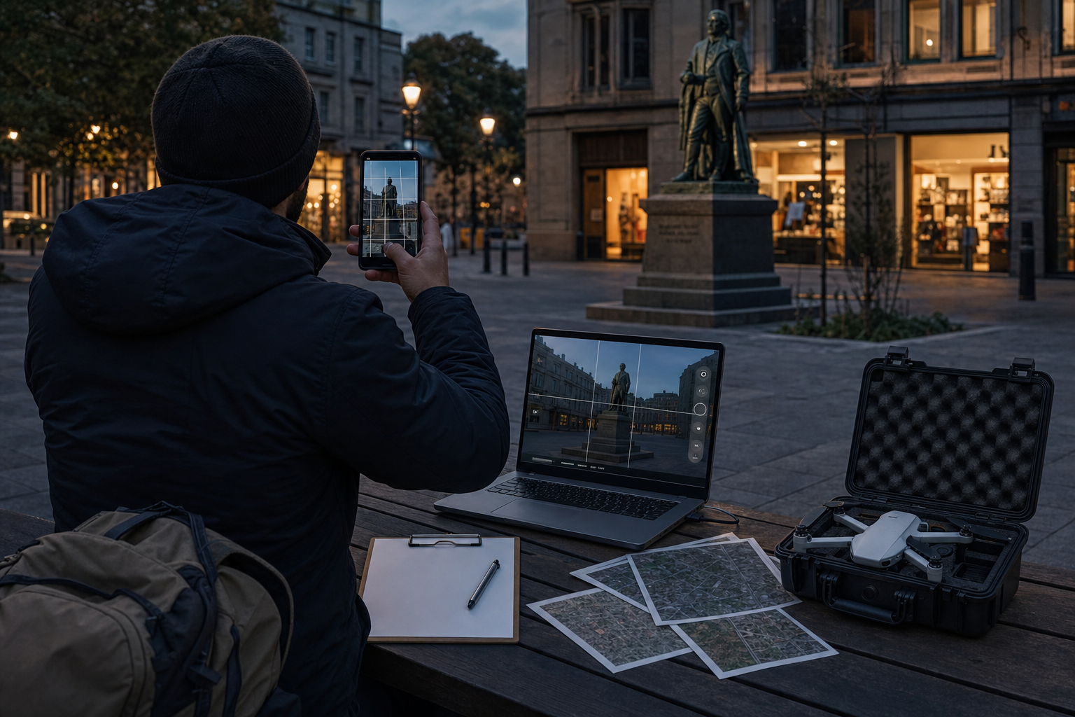
A recent online debate pushed an uncomfortable question into public view: if people scan streets, statues, parks, and storefronts for a game like Pokémon Go, can that same data later help train navigation systems for drones, robots, or other AI tools? The specific claim that player scans are directly feeding military drone systems is, at least from public evidence, not fully proven in detail. But the broader concern is credible. Consumer apps now collect rich spatial data, and that data can be useful far beyond the original product.
This matters because spatial data has a long afterlife. A scan made for an augmented reality game can also support visual positioning, mapping, robotics, autonomous navigation, and yes, potentially defense-related systems. The main debate is not whether such reuse is technically possible. It is whether people gave meaningful consent for it. My view is simple: if companies want to turn play, curiosity, or convenience into training data for high-stakes AI systems, they should have to ask plainly.
A plausible pipeline, even when the headline outruns the evidence
It is important to separate the dramatic version of this story from the solid one.
The dramatic version says a player points a phone at a park bench to catch a virtual creature, and that exact scan later becomes military drone training data. That direct chain is the part that is often asserted more confidently than it has been publicly documented.
The solid version is less sensational and more important. Companies that gather large volumes of real-world imagery and 3D scans are building valuable datasets for machine perception. Those datasets can help systems learn how to recognize landmarks, estimate position when GPS is weak, understand depth, and move through the physical world more reliably. That is useful for consumer AR, delivery robots, warehouse systems, self-driving features, and many forms of drone navigation.
In other words, even if one viral claim goes too far, the underlying ethical issue still stands. The data economy increasingly works by collecting information in one setting and extracting value from it in another.
Why this kind of data is so valuable
A photo of a street corner is not just a photo anymore. Combined with location tags, timestamps, multiple angles, and repeated scans from many users, it becomes part of a machine-readable map.
That map can teach navigation systems to identify a building facade, a sign, a plaza entrance, or a row of windows. If GPS is blocked, jammed, or simply inaccurate, a system can use visual cues to estimate where it is. That has obvious commercial value. It also has obvious strategic value.
This is why the consent question cannot be brushed aside as a niche concern. Spatial AI does not need people to label every image by hand. It needs volume, coverage, and variety. Games and consumer apps are very good at producing exactly that, often at low cost and with little friction.
The user experience feels small. Scan this object. Walk this route. Unlock this feature. The downstream value can be very large.
Public space is not the same as public consent
The usual defense is easy to predict: these are public places. Streets, monuments, parks, and storefronts are visible to anyone. Why should mapping them require special permission?
That argument is not meaningless, but it is incomplete. Seeing a place is not the same as contributing to a reusable AI dataset built from systematic collection. Public visibility does not erase the question of purpose.
If a user scans a mural so a game can place digital objects more accurately, that person may reasonably understand the act as part of gameplay. They are not necessarily agreeing, in any meaningful human sense, to support commercial navigation systems, security applications, or military uses. A broad clause in a terms-of-service document does not solve that gap. It may protect a company legally. It does not settle the ethical issue.
Consent matters here because the meaning of the contribution changes with the use. A game feature, an AR map, a delivery robot, a police tool, and a defense system are not morally interchangeable just because they rely on similar technical foundations.
The strongest counterargument, and why it still falls short
There is a reasonable case for data reuse. Companies will say that secondary use helps innovation, reduces waste, and supports beneficial tools. A stronger navigation model could help emergency response teams, improve accessibility tools for people with low vision, or allow drones to operate in disaster zones where normal infrastructure has failed. Some will also argue that better navigation in military settings could reduce accidental harm by improving precision.
Those points should be acknowledged. Not every defense-related use is automatically reckless, and not every repurposing of data is abusive.
But none of that removes the need for choice. A useful outcome does not create retroactive consent. The fact that a dataset could support both civilian and military applications is exactly why the user should be told more, not less.
There is also a practical reason to insist on this. Trust is easier to lose than to rebuild. When people feel tricked into contributing to systems they never intended to support, the backlash does not stop at one company. It spreads across the wider field of AI, mapping, and consumer tech.
Why broad terms are not enough
Tech companies often rely on a familiar model: disclose everything somewhere, make participation technically voluntary, and treat continued use as consent. That model was already weak for social media and ad tracking. It is even weaker for spatial AI.
Most users do not read dense legal agreements. More important, even careful readers cannot infer every future use from vague language about improving services, partners, research, or platform development. Spatial data is unusually flexible. Its future value often lies in applications that do not exist yet, or that companies do not want to advertise clearly because the wording would deter participation.
That is the heart of the problem. If a company believes plain language would scare users away, that is a sign the company understands the consent is not robust.
What meaningful consent would look like
If companies want to keep collecting real-world scans from ordinary users, the standard should be higher than a buried disclosure.
- Clear notice at the moment of collection. Before a scan is uploaded, users should see what is being collected and simple examples of how it may be used.
- Separate choices for separate uses. Gameplay improvement, commercial mapping, public-sector applications, and defense or security uses should not be bundled into one all-purpose yes.
- A real ability to decline. Users should be able to say no to secondary uses without being locked out of the entire product.
- Deletion and retention rules. People should be able to remove contributions where feasible, and companies should not store sensitive spatial data indefinitely by default.
- Transparency reports. Firms should publish what categories of partners use the data and for what kinds of systems.
- Stronger safeguards for sensitive places. Schools, hospitals, places of worship, private homes, and vulnerable communities deserve extra protection.
None of this would stop innovation. It would force honesty. That is not the same thing.
The bigger issue is invisible labor
There is another human question behind this story. People are not just generating content anymore. They are helping build the operating layer for machine navigation, often without realizing it.
That contribution has value. It comes from time, attention, battery life, bandwidth, movement through neighborhoods, and access to places companies could not cheaply map on their own. In effect, users are doing distributed fieldwork. Yet the economic and strategic value flows upward, while the explanation to users often stays minimal.
This does not mean every contributor should be paid as a map contractor. It does mean the old fiction of “just using an app” no longer fits the reality. In many cases, users are participating in data production for systems far larger than the product in front of them.
This will not stop with games
The same pattern is spreading across phones, cars, smart glasses, delivery networks, security cameras, and consumer robots. Everyday devices are turning physical spaces into training material for AI models that need to interpret the world.
That creates real promise. Better maps can support safer navigation, better accessibility, and new services that genuinely help people. But it also creates a quiet transfer of power. The companies that own the datasets, the models, and the partnerships gain the ability to shape how places are represented and how machines move through them.
If consent stays weak at the start, the public will be asked to accept the consequences later, once the infrastructure is already in place.
A simple standard
Even if the most alarming version of the Pokémon Go-to-drone story remains partly unproven, the central lesson is already clear. When consumer spatial data can travel into high-stakes AI systems, vague disclosure is not enough.
The fair standard is simple: if a company wants people to help build navigation intelligence for uses beyond the product they signed up for, it should ask directly, in plain language, before the data is absorbed into the system. A game is not a blank check. Neither is a sidewalk.